

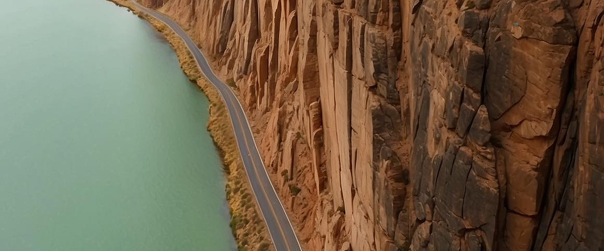
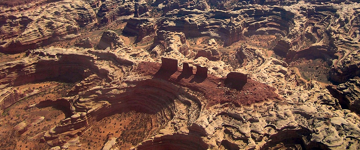
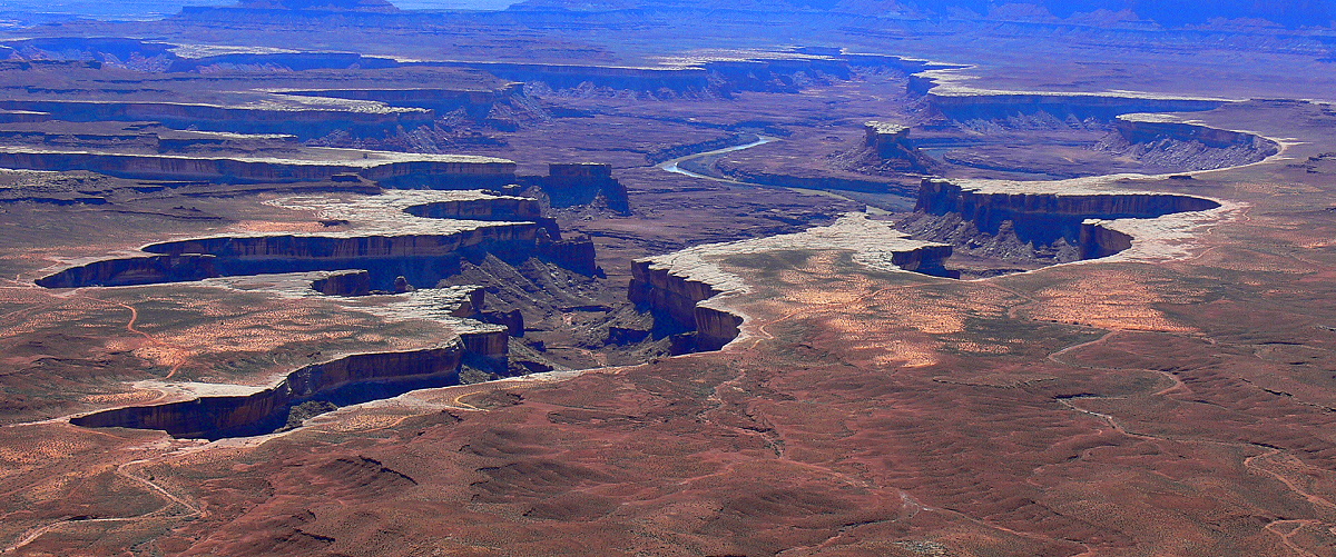
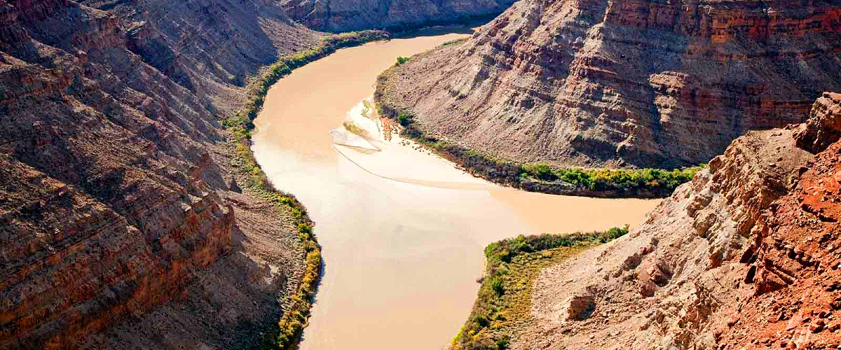
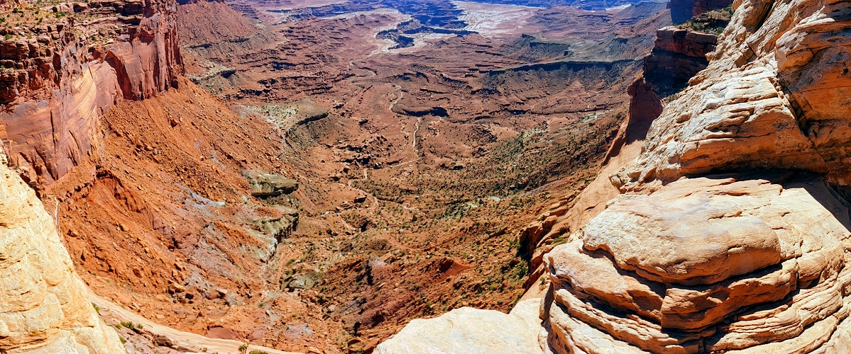
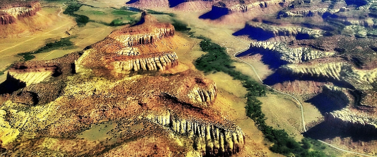
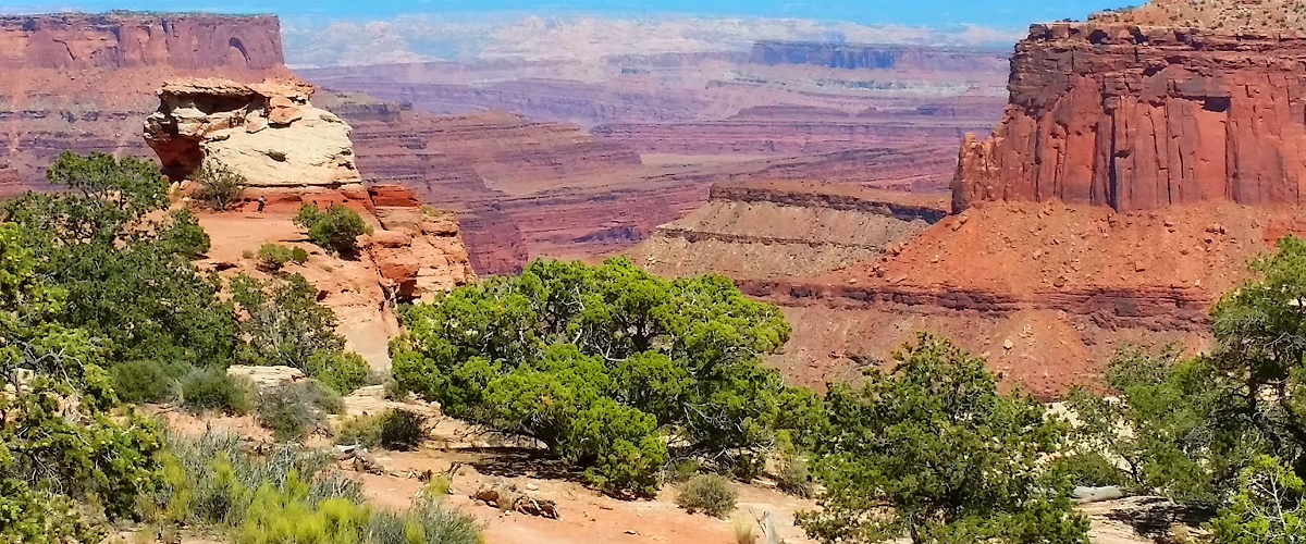
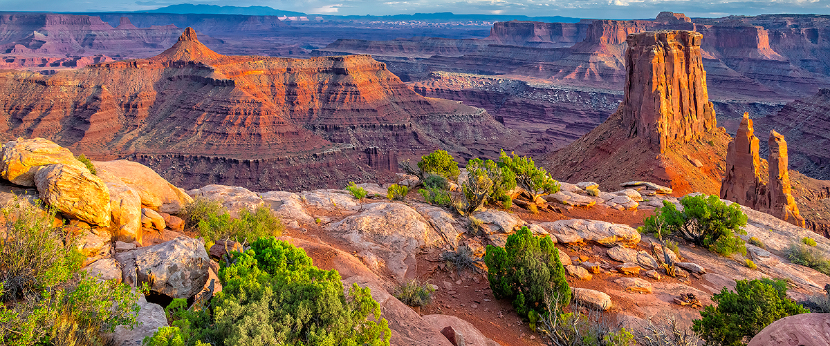
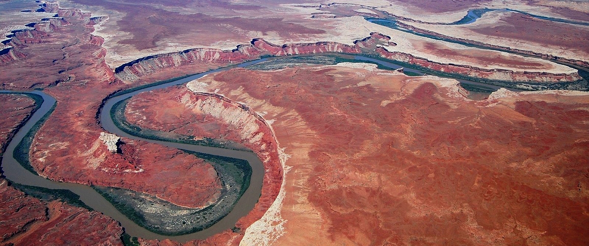
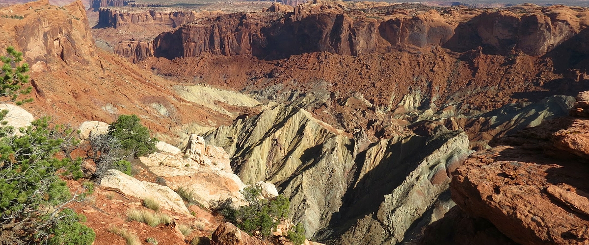
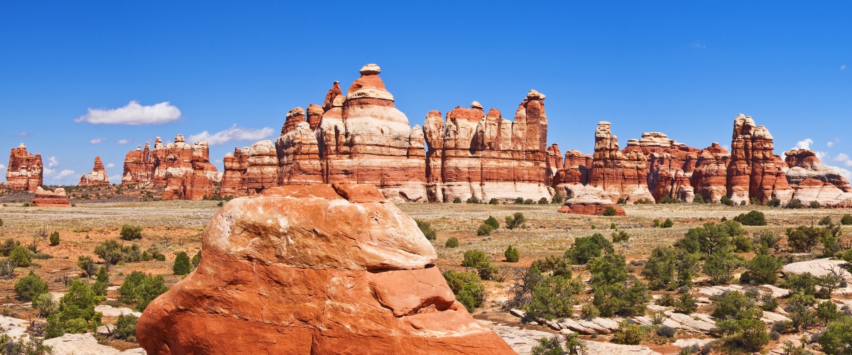
Canyonlands National Park is located in southeastern Utah with the confluence of the Green and Colorado rivers located near the center of the park. The area had been promoted during the 1930s for inclusion into the park system as part of a much larger Escalante National Monument. However, that effort did not succeed, and in 1961 Utah Senator Frank Moss introduced legislation in the United States Senate calling for the establishment of Canyonlands National Park. After considerable opposition within the state, the legislation was passed and on 12 September 1964 President Lyndon Johnson signed the act making Canyonlands the thirty-second national park. The park is the largest of Utah's five national parks, with a total of 337,258 acres. It is known for its rivers, canyons, mesas, pillars, standing rocks, grabens, and arches. All the rocks in Canyonlands are sedimentary.
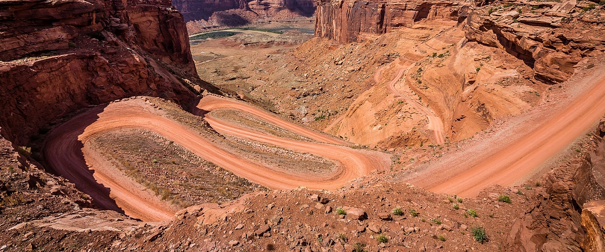
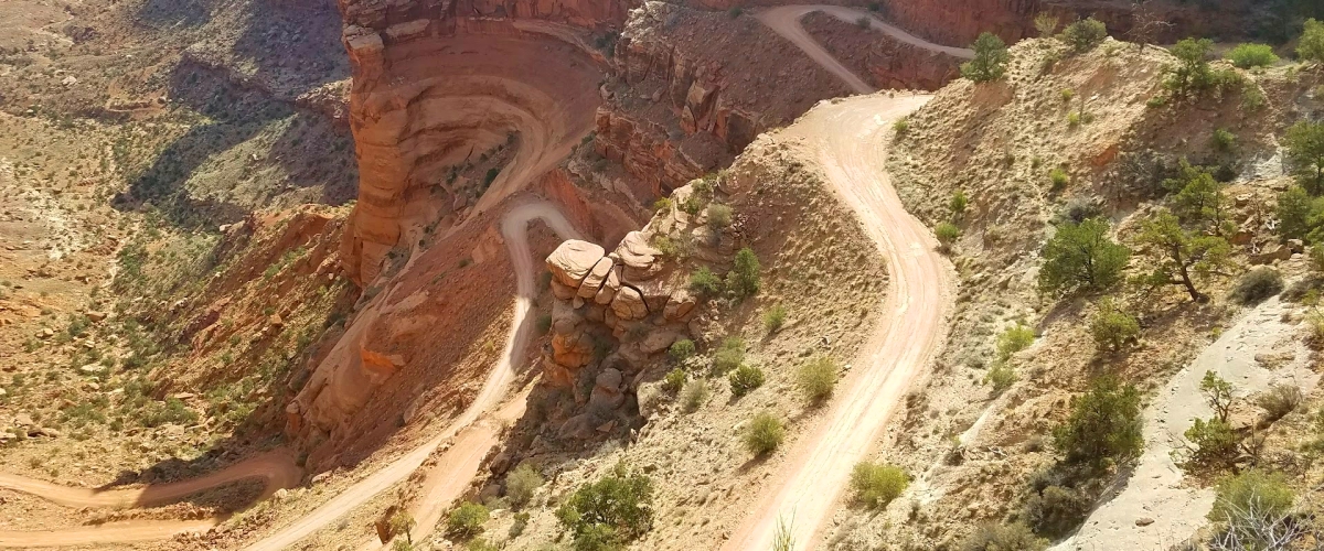
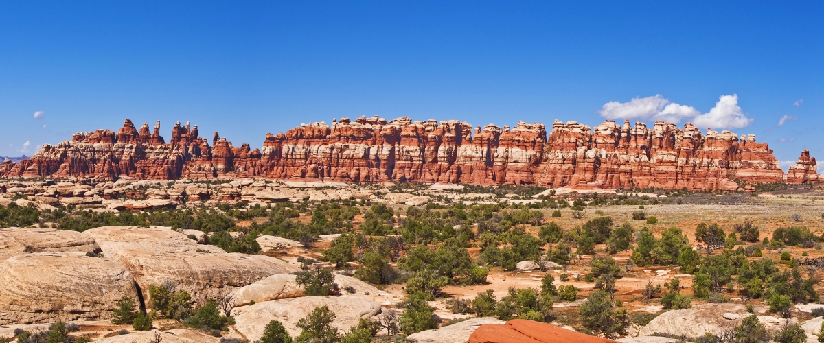
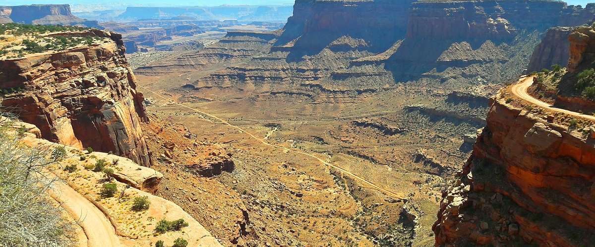
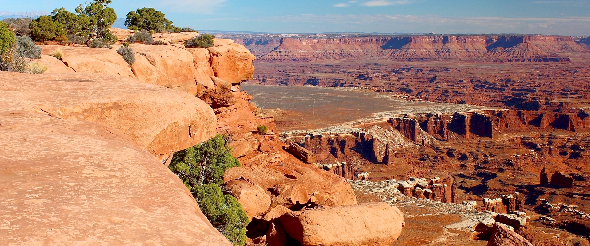
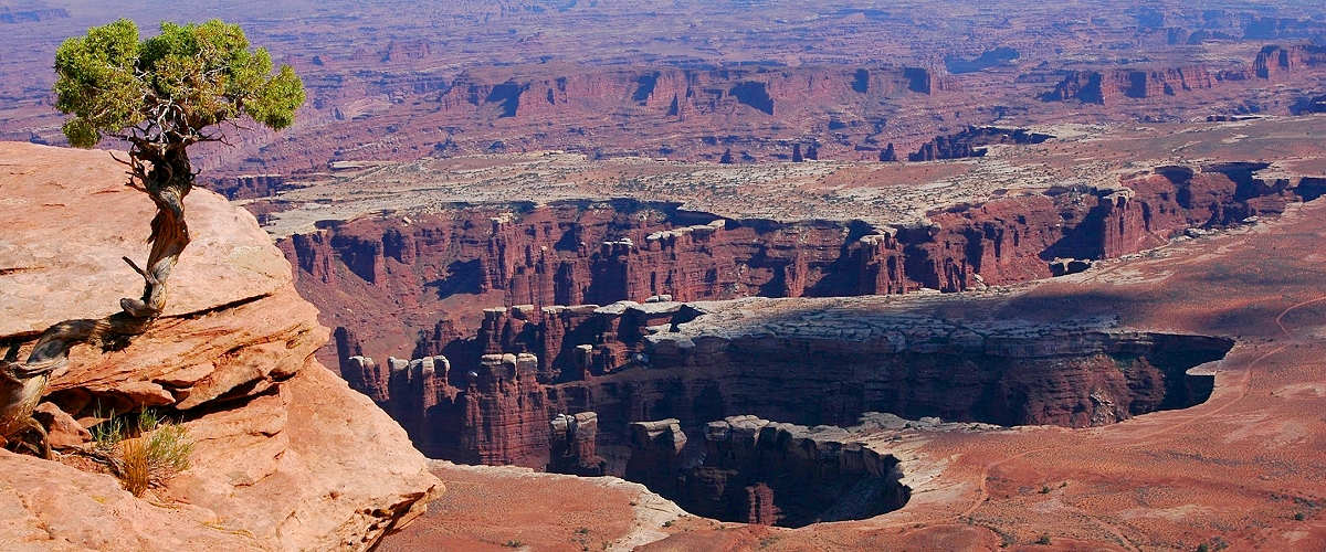
Canyonlands was home to the Fremont people and the Anasazi. The Fremont people left records in the form of pictographs and petroglyphs in Horseshoe Canyon and Salt Canyon. The Anasazi built several granaries, like Keyhole Ruin, probably in the twelfth century. Ute and Navajo Indians subsequently occupied the canyons until the late 1800s. They were eventually pushed out of the area by cattlemen. In 1869 and 1871 John Wesley Powell explored the Green and Colorado rivers as they traveled through Canyonlands. Today, the park is divided into three districts, Island in the Sky, Needles, and Maze-Standing Rock. Island in the Sky is the northernmost district. It is a high and extensive mesa located in the area between the Green and Colorado rivers. Some of the popular attractions in this area are Upheaval Dome, Shafer and White Rim Trails, Grand View Point, and Monument Canyon. Needles, or the southern district, is the area east of the Colorado River. Angel Arch, Druid Arch, Paul Bunyans Potty, the Grabens, Elephant Hill, and Needles are common attractions. This area contains most of the artifacts from the Fremont people and the Anasazi in Salt, Davis, and Lavender Canyons. The Maze-Standing Rocks District is located west of the Colorado River after its confluence with the Green River. This section is known for Elaterite Basin, Elaterite Butte, the Maze, Standing Rocks, the Doll House, the Fins, and Ernies Country. The Canyonlands districts are not connected by inner roads. Visitors must leave the park to enter another district. In several areas, the park is not developed, and many of the sites can be seen only by hiking. Headquarters for the park is in Moab, with visitor centers located in each of the three districts.

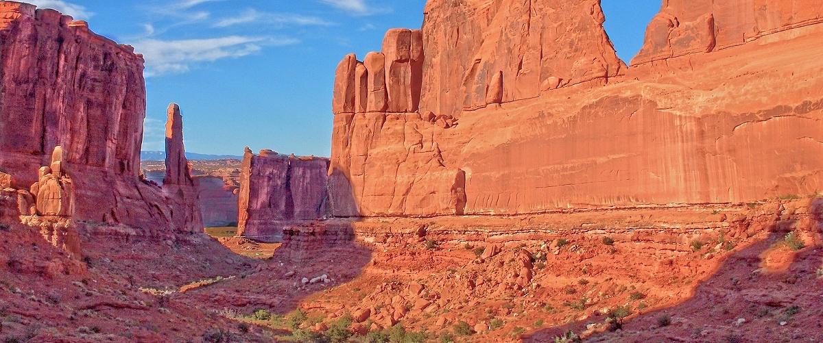
ENJOY THIS EXTENDED VIEW OF CANYONLANDS NATIONAL PARK
Explore Utah was created and is maintained by Explore Utah Online ©2020-2026 (All Rights Reserved) This website was created for the enjoyment of Utah. If you believe copyrighted work is available on this website in a way that constitutes a copyright infringement please contact me for removal. All rights to the images and other materials used belong to their respective owners. I do not claim ownership over any third-party content used. Photos on this website are used for educational purposes only and used with permission and courtesy of: Scott Taylor - Albert Wirtz - Angela Banfield - Catherine Colella - Chase Bartholomew - Danielle Yung - Elliott Hammer - Francisco Ovies - George Gibbs - Greg Kebbekus - Hilary Bralove - Jacob Moogberg - Jim Paton - Jim and Nina Pollock - John Dahlstet - Jay Luber - Jessica Holdaway - John Hammond - John Dahlstet - Logan Selinski - Logan Selinski - Michelle Leale - Mae Thamer - Mark Thompson - Mia & Steve Mestdagh - Michelle Leale - Randy Baumhover - Sven Hähle - Shawn Anthony - Thomas Eckhardt - Thomas Jundt - University Of Utah - Bureau of Land Management - Utah Education Network - Utah History Encyclopedia - Utah League of Cities and Towns - Utah Geological Survey - Ski Utah - Free To Use Photo Websites: Unsplash - Pexels - Freepik - Pixabay - iStock - ShutterStock - Burst - Flickr - PickPik - Rawpixel - HistoryPictureArchive This website contain links to third party websites. The linked sites are not under the control of this website and is not responsible for the contents of any linked website. These links are provided as a convenience only and shall not be construed as an endorsement of, sponsorship of, or affiliated with the linked website ... Send your comments or questions to webmaster@exploreutah.online