


Take a live look down Interstate 15 as it runs 400 miles through the heart of Utah. I-15 runs north to south through the southwestern and central portions of the state, passing through most of the state's largest cities. It is Utah's primary and only north to south interstate highway. In 1998 the Utah State Legislature designated Utah's entire portion of the highway as the Veterans Memorial Highway. The southern section runs through Utah, Juab, Millard, Beaver, Iron and Washington counties from the Traverse Mountains to the Arizona state line through the cities of Lehi, American Fork, Orem, Provo, Spanish Fork, Payson, Nephi, Fillmore, Beaver, Cedar City, Washington and St George. Click below for the full size picture (opens in new tab). Reload this page for the most current pictures.
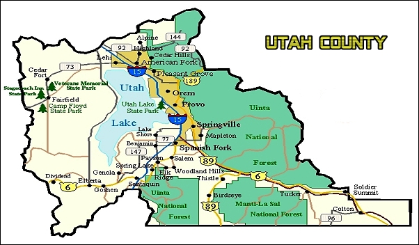
Utah County
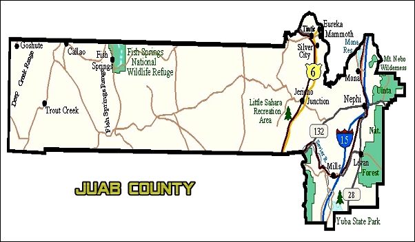
Juab County
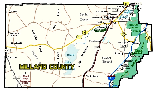
Millard County
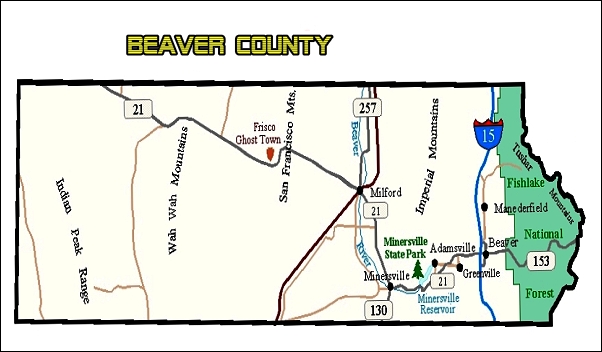
Beaver County
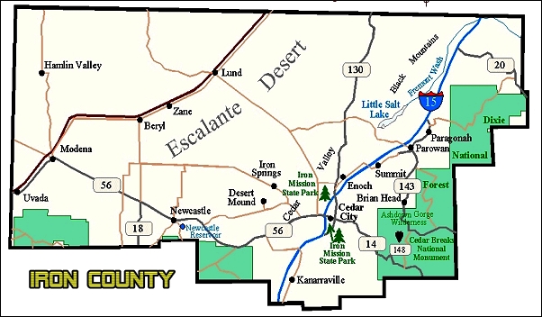
Iron County
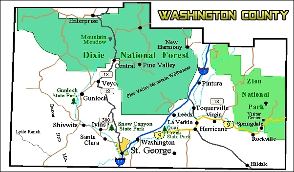
Washington County
Explore Utah was created and maintained by Explore Utah Online 2020-2026 This website was created for the enjoyment of Utah. Send your comments or questions to webmaster@exploreutah.online
 The live webcam images above are provided by
the Utah Department of Transportation as a public service. Information is published automatically; accuracy cannot be guaranteed.
Availability of information is dependent upon several factors that are beyond the control of the Utah Department of Transportation, such as internet
services, cameras, communications networks, and computer equipment. While information is designed to be delivered in real time, the Utah
Department of Transportation website is only monitored Monday-Friday, 7am-6pm, excluding state holidays. Weather and road conditions change
swiftly; therefore, drivers are in the best position to analyze conditions and adjust their driving accordingly. Those relying on the above
camera information above do so at their own risk. The state of Utah, the Utah Department of Transportation, or Explore Utah Online are not
liable for the accuracy of this information. 7JUL2026
The live webcam images above are provided by
the Utah Department of Transportation as a public service. Information is published automatically; accuracy cannot be guaranteed.
Availability of information is dependent upon several factors that are beyond the control of the Utah Department of Transportation, such as internet
services, cameras, communications networks, and computer equipment. While information is designed to be delivered in real time, the Utah
Department of Transportation website is only monitored Monday-Friday, 7am-6pm, excluding state holidays. Weather and road conditions change
swiftly; therefore, drivers are in the best position to analyze conditions and adjust their driving accordingly. Those relying on the above
camera information above do so at their own risk. The state of Utah, the Utah Department of Transportation, or Explore Utah Online are not
liable for the accuracy of this information. 7JUL2026