


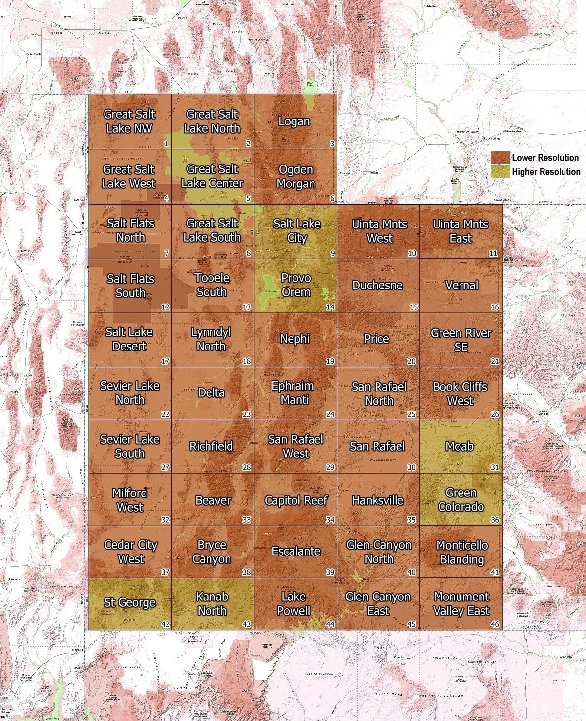
Choose a section below for the full size topographic map. Each map will open up in a new window for printing or saving. Topographic maps show the three-dimensional surface of the earth in two dimensions using elevation-contour lines. They provide direction, location coordinates, scale, and description of features, such as roads, trails, canals, streams, towns, and political and geographic boundaries. These are lower resolution topographic maps of Utah ard were produced by the Utah Geological Survey and other federal agencies from 1980 data. Working on newer and higher resolution maps as data becomes available.
Explore Utah was created and is maintained by Explore Utah Online ©2020-2025 (All Rights Reserved) This website was created for the enjoyment of Utah. Send your comments or questions to webmaster@exploreutah.online