


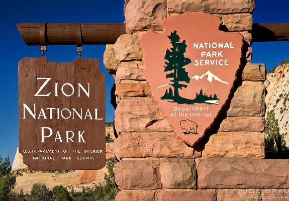
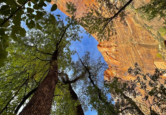
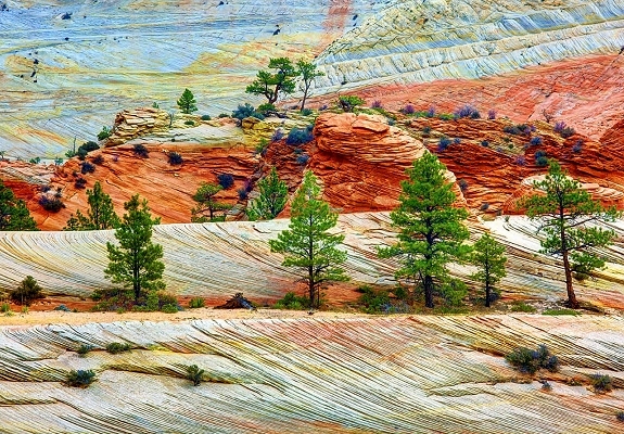
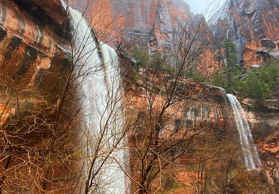
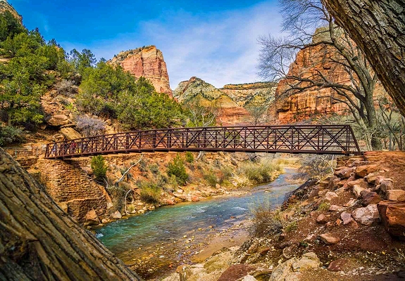
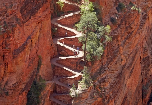
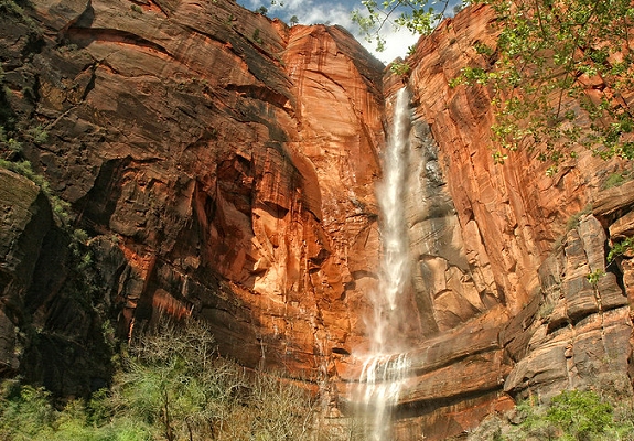
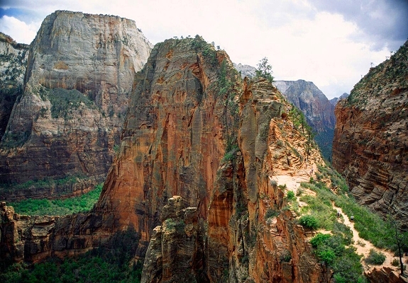
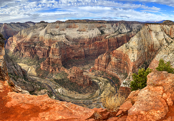
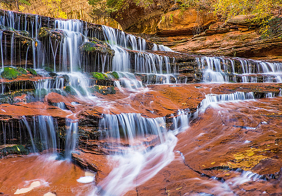
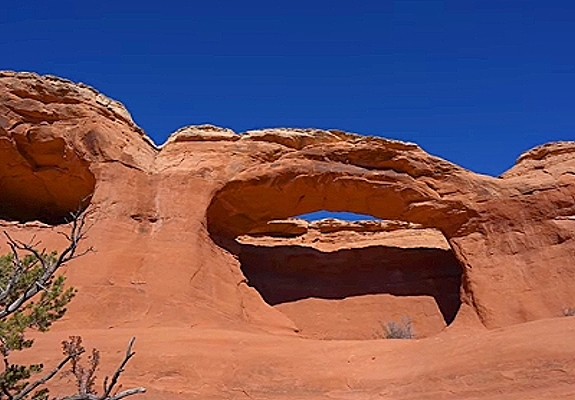
Follow the paths where native people and pioneers walked. Gaze up at massive sandstone cliffs of cream, pink, and red that soar into a brilliant blue sky. Experience wilderness in a narrow slot canyon. Zion's unique array of plants and animals will enchant you as you absorb the rich history of the past and enjoy the excitement of present day adventures. Known for its sheer 2,000-foot cliffs and river-carved canyons, Zion deserves to be on every Utah travel agenda. Zion is home to some of the most iconic views and trails in the National Park Service, and everyone seems to know it. Overcrowding at this park is common. It's impossible to have a bad view in Zion. The Lower Emerald Pool Trail is a paved path that leads to the gorgeous green waters of the Lower Emerald Pool and waterfalls. Short and steep, the Weeping Rock Trail showcases Zion's hanging gardens. The 5 mile Angel's Landing Trail is not for the faint of heart. The trail has steep drop-offs, and there are sections where only a chain provides support as visitors pass in both directions. The trail takes you to a peak in the middle of Zion Canyon. The out-and-back trail includes 1,500 feet of elevation gain and takes roughly four hours to hike. The Narrows is an unforgettable gorge with soaring walls, sandstone grottos, natural springs, and hanging gardens in the upper reaches of Zion Canyon. Also consider hiking the 14 mile trail to Kolob Arch, one of the largest natural arches on earth. There is no match for the soaring perspective on trails like Angels Landing and the Narrows, but you don't have to hike to see why the park is so special. The roadways leading through Zion provide ample viewing opportunities. While its massive backcountry trail system can make for an incredible extended stay, the unbridled beauty from basically any spot in the park coupled with easy access makes Zion a perfect one-day trip. However, if it's your first visit, try to spend at least two or three nights and venture to both Zion Canyon and Kolob Canyons.


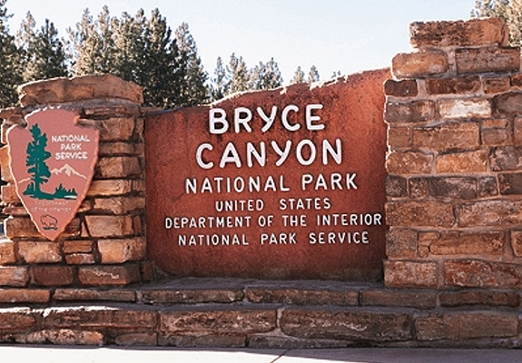
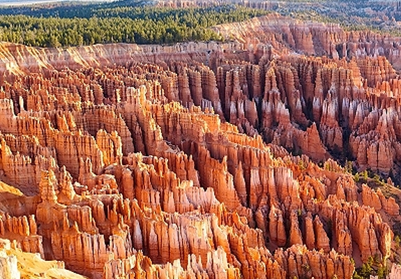
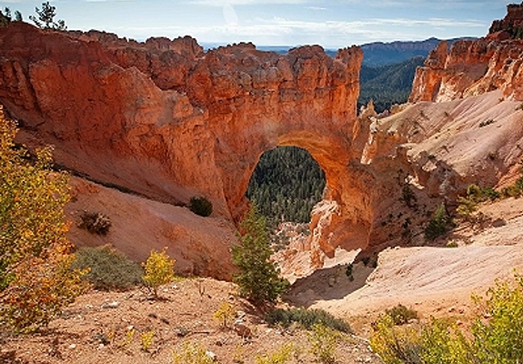
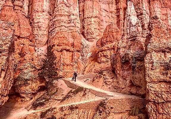
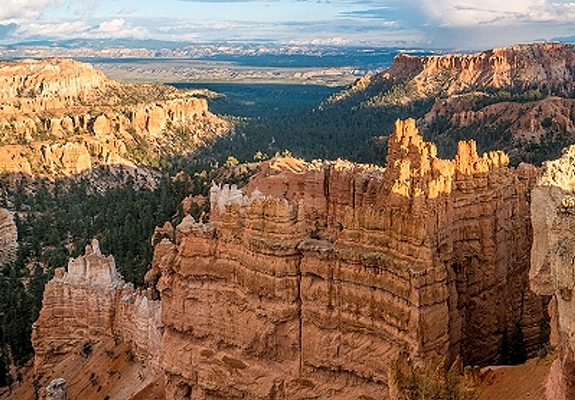
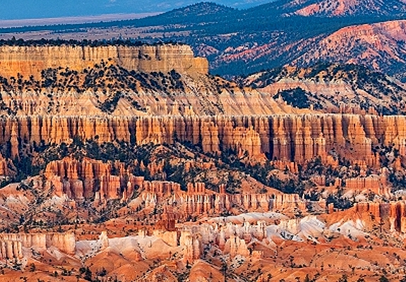
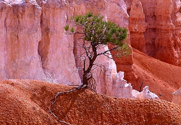
Bryce Canyon National Park is located in southern Utah on the eastern side of the Paunsaugunt Plateau in Garfield County. Settlement of the area began in 1874. Ebenezer Bryce moved from Pine Valley and settled a site near the mouth of Bryce Canyon in 1875. Bryce used the now famous canyon as a cattle range, and it was given his name as early as 1876. Despite the fragile nature of the environment, there are many miles of foot and horse trails below the rim. A twenty-mile paved highway runs along the edge of the rim. Bryce Canyon awaited promotion and development before its full tourism potential could be realized. National Forest Supervisor JW Humphrey was transferred from the La Sal National Forest to the Powell National Forest in July 1915. He was amazed at the beauty and grandeur of Bryce and resolved to do all he could to promote it and make it accessible. He took visiting dignitaries to Bryce and secured funds for a passable road to the canyon rim. In 1916 Arthur W Stevens of the Forest Service wrote an illustrated article for the Union Pacific railroad tourist magazine. JW Humphrey wrote a similar article for the Rio Grande railroad. These were the first descriptive articles published about Bryce Canyon. In the meantime, moving pictures and postcards began circulating and Bryce began to attract visitors from all parts of the nation. In 1919 the Utah state legislature asked Congress to create Bryce National Monument, which was done in 1923. The Union Pacific railroad acquired a state school section on the rim and began developing campgrounds, cabins, a lodge, and improved access to the Canyon. In 1928 Bryce Canyon was removed from Forest Service jurisdiction and made Bryce Canyon National Park. Later 12,000 additional acres were added to create what is now a 37,277 acre park that attracts hundreds of thousands of visitors each year from throughout the world to marvel at its unique beauty.


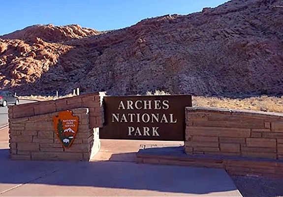
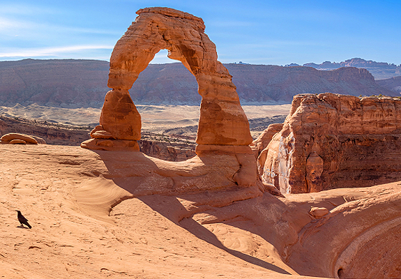
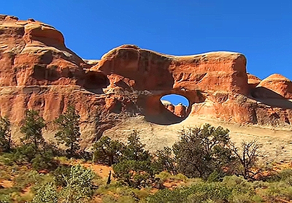
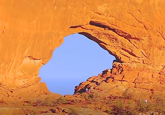
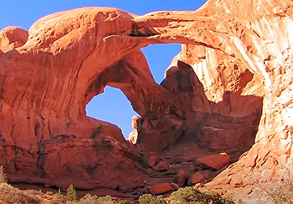
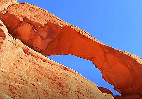
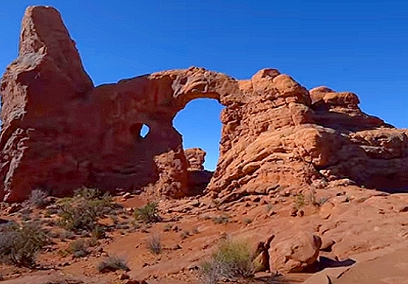
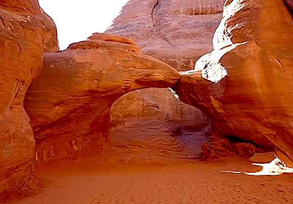
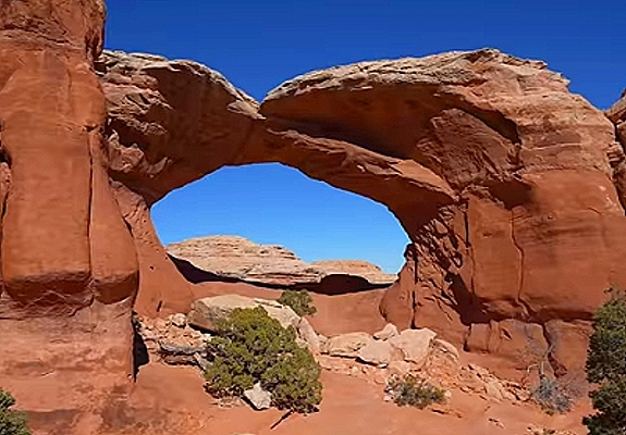
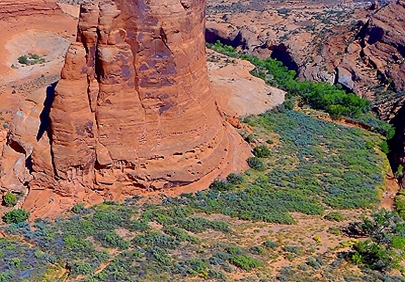
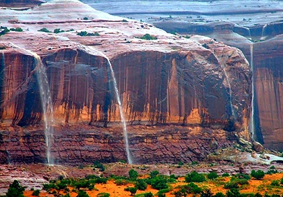
Located just 5 miles north of Moab is Arches National Park, which contains the world's largest concentration of natural sandstone arches. Although over 2,000 arches are located within the park's 76,518 acres, the park also contains an astounding variety of geological formations. Colossal sandstone fins, massive balanced rocks, soaring pinnacles and spires dwarf visitors as they explore the park's hiking trails. A paved scenic drive takes visitors to many of the major viewpoints within the park. There is one road that travels through Arches National Park and that is Arches Scenic Drive. The best time to visit Arches National Park is in the spring and the fall when temperatures are mild. However, while winter weather in Arches may not be the most predictable, the sheer lack of crowds makes it one of the best times of the year to visit. Thankfully, despite its high altitude, the park rarely sees heavy snowfall and the entire park is accessible throughout the whole year. The park is part of the Colorado Plateau with a high desert biosphere. The Arches National Park lies on top of a salt bed which underwent extreme climate changes millions of years ago. The debris from floods and ocean waters compressed into rock, pushing the earth upward into domes and down into hollow pockets. Faults also occurred such as the park's Moab Fault, one of the most highly studied geologic zones in the country. Vertical arches resulted from these conditions, and rock layers that weren't eroded away with time still stand today. Petrified sand dunes can also be found here which indicate where ancient lakes covered the area.


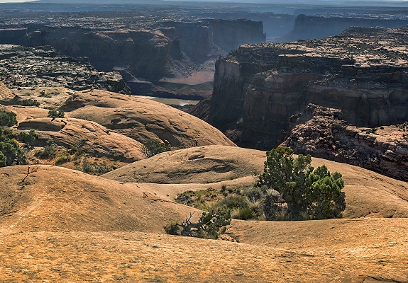
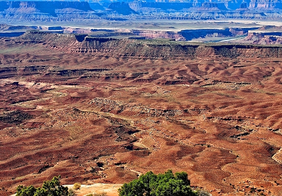
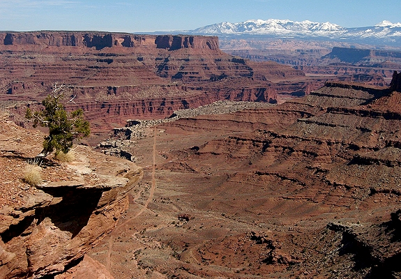
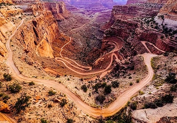
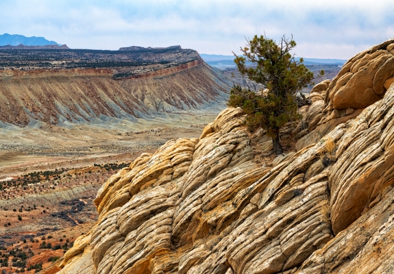
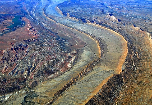
Carved-out canyons. Sheer drop-offs. Body-wide footpaths slicing through red rock. Exploring Canyonlands National Park is touring with an edge. The whole park is a redrock woodcut engraved by wind's and water's big, slow chisels. The Green and Colorado Rivers trisect the Colorado Plateau, etching Canyonlands into distinct districts. The mesas you see at Island in the Sky look like a mountain range lopped off by a broadsword. The Maze is gorges, gorgeously gouged. Needles is a pincushion, pointy-sides-out. Chopped buttes, scored sediment and carved petroglyphs. Lots of sculpting, scraping and dividing asunder. Island in the Sky is the most accessible district in the park, nearest to a major city (Moab) and boasting a paved scenic drive with views of the surround buttes, fins and water-carved canyons, as well as numerous hikes. The Needles is less accessible, requiring more time, more strenuous hiking and four-wheel drive or boat ride to reach its secret corners, but it provides incredible backcountry approaches into some of the most dazzling landscape on earth. But even the Needles feels like a roadside B&B compared to the remoteness of The Maze, the isolated district west of the Green River. The Maze offers challenging backpacking, off-roading and hiking for seasoned explorers. If you're feeling the life aquatic, you can also book a river trip on the Green or Colorado and see the whole thing from a boat.


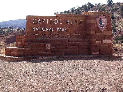
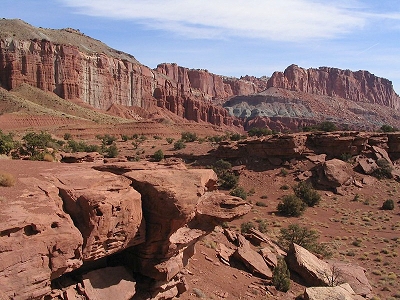
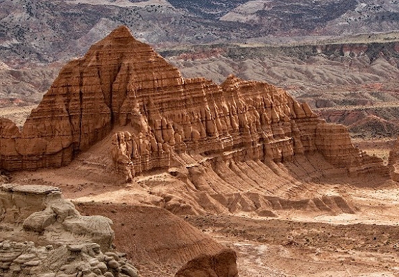
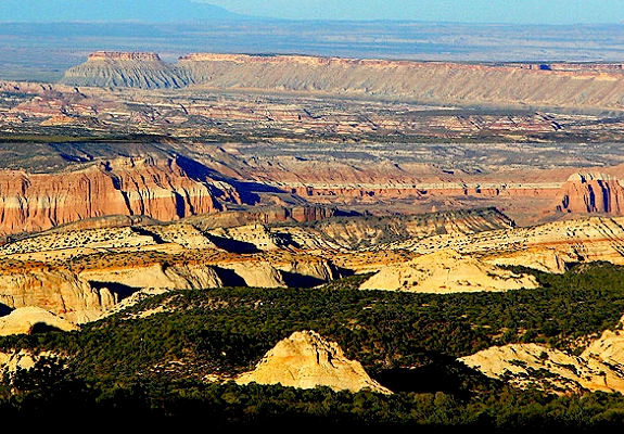
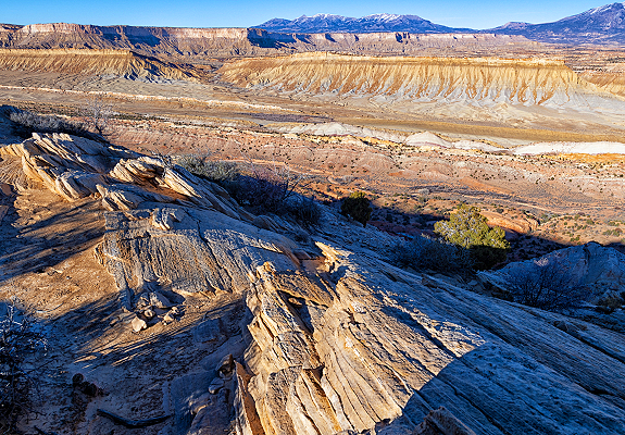
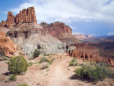
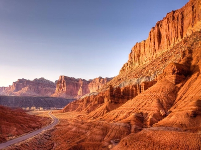
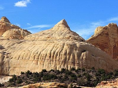
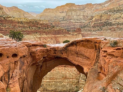
Capitol Reef National Park encompasses the Waterpocket Fold, a warp in the Earth's crust that is 65 million years old. It is the largest exposed monocline in North America. In this fold, newer and older layers of earth folded over each other. The park is filled with brilliantly colored sandstone cliffs, gleaming white domes, and contrasting layers of stone and earth. The area was named for a line of white domes and cliffs of Navajo Sandstone, each of which looks somewhat like the United States Capitol building, that run from the Fremont River to Pleasant Creek on the Waterpocket Fold. The fold forms a north-to-south barrier that has barely been breached by roads. Early settlers referred to parallel impassable ridges as "reefs", from which the park gets the second half of its name. State Route 24 cuts through the park traveling east and west between Canyonlands National Park and Bryce Canyon National Park, but few other paved roads invade the rugged landscape. The park is filled with canyons, cliffs, towers, domes, and arches. The Fremont River has cut canyons through parts of the Waterpocket Fold, but most of the park is arid desert.


Explore Utah was created and is maintained by Explore Utah Online ©2020-2026 (All Rights Reserved) This website was created for the enjoyment of Utah. If you believe copyrighted work is available on this website in a way that constitutes a copyright infringement please contact me for removal. All rights to the images and other materials used belong to their respective owners. I do not claim ownership over any third-party content used. Photos on this website are used for educational purposes only and used with permission and courtesy of: Scott Taylor - Albert Wirtz - Angela Banfield - Catherine Colella - Chase Bartholomew - Danielle Yung - Elliott Hammer - Francisco Ovies - George Gibbs - Greg Kebbekus - Hilary Bralove - Jacob Moogberg - Jim Paton - Jim and Nina Pollock - John Dahlstet - Jay Luber - Jessica Holdaway - John Hammond - John Dahlstet - Logan Selinski - Logan Selinski - Michelle Leale - Mae Thamer - Mark Thompson - Mia & Steve Mestdagh - Michelle Leale - Randy Baumhover - Sven Hähle - Shawn Anthony - Thomas Eckhardt - Thomas Jundt - University Of Utah - Bureau of Land Management - Utah Education Network - Utah History Encyclopedia - Utah League of Cities and Towns - Utah Geological Survey - Ski Utah - Free To Use Photo Websites: Unsplash - Pexels - Freepik - Pixabay - iStock - ShutterStock - Burst - Flickr - PickPik - Rawpixel - HistoryPictureArchive This website contain links to third party websites. The linked sites are not under the control of this website and is not responsible for the contents of any linked website. These links are provided as a convenience only and shall not be construed as an endorsement of, sponsorship of, or affiliated with the linked website ... Send your comments or questions to webmaster@exploreutah.online